Figure 2
Download original image
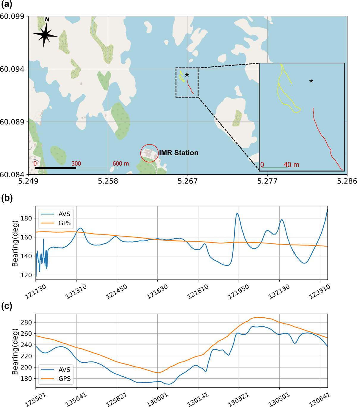
Trials were conducted to verify the instrument (M20-105) using a known source transmitting a signal of 100 Hz. (a) Trial location with the boat tracks. The instrument system (black star) was deployed on the sea bottom. The deployment location (latitude: 60.0937°, longitude: 5.2670°) was about 800 m from the sea cages of the Institute of Marine Research’s Austevoll Research Station (the red circle). The active source was suspended 5 m below the boat Tabben (MMSI: 257033570), and the red (free drift trial) and yellow (maneuvering trial) curves denote the boat tracks. (b) Bearing comparison between AVS and GPS when the boat drifted freely with engine off. (c) Bearing comparison between AVS and GPS when the boat was maneuvered close to, and west/southwest of the deployment location. In (b) and (c), the AVS bearing (blue line) shows the bearing of the 100 Hz signal with local time displayed on the x-axis (HHMMSS). The GPS bearing (orange line) was computed from the GPS positions of the boat (the sound source) to the AVS deployment position.
Current usage metrics show cumulative count of Article Views (full-text article views including HTML views, PDF and ePub downloads, according to the available data) and Abstracts Views on Vision4Press platform.
Data correspond to usage on the plateform after 2015. The current usage metrics is available 48-96 hours after online publication and is updated daily on week days.
Initial download of the metrics may take a while.