Figure 3
Download original image
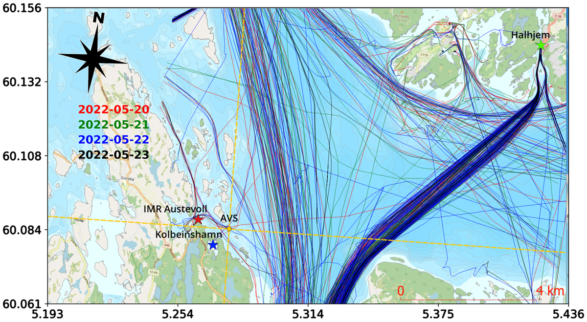
Location of the field measurements in the Bjørnafjorden, Norway. The measurement instrument system (denoted as AVS; the orange point) was deployed on the sea bottom. The deployment location (latitude: 60.0871°, longitude: 5.28062°) was about 820 m from the Institute of Marine Research’s Austevoll Research Station (the red star), 650 m from the harbor in Kolbeinshamn (the blue star), and 10 km from the ferry stop at Halhjem (the green star). Ship traffic tracks during the measurement period are presented as colored lines, given by the GPS positions of the AIS data. The orange dashed lines assist in visualizing the four quadrants of the directional measurements made by the AVS.
Current usage metrics show cumulative count of Article Views (full-text article views including HTML views, PDF and ePub downloads, according to the available data) and Abstracts Views on Vision4Press platform.
Data correspond to usage on the plateform after 2015. The current usage metrics is available 48-96 hours after online publication and is updated daily on week days.
Initial download of the metrics may take a while.